TBSD60
 BSD120
 BSD98
BSD98 BSD70
BSD70 BSD60
BSD60 BSD50
BSD50 BSD217
 INS1700
 INS970
 INS570
 INS170
 SLA-4B1L1-65
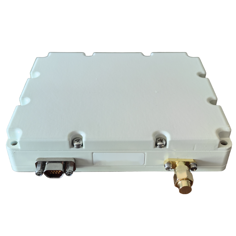 SLA-8B1L1-110
 SLA-4B1L1-130
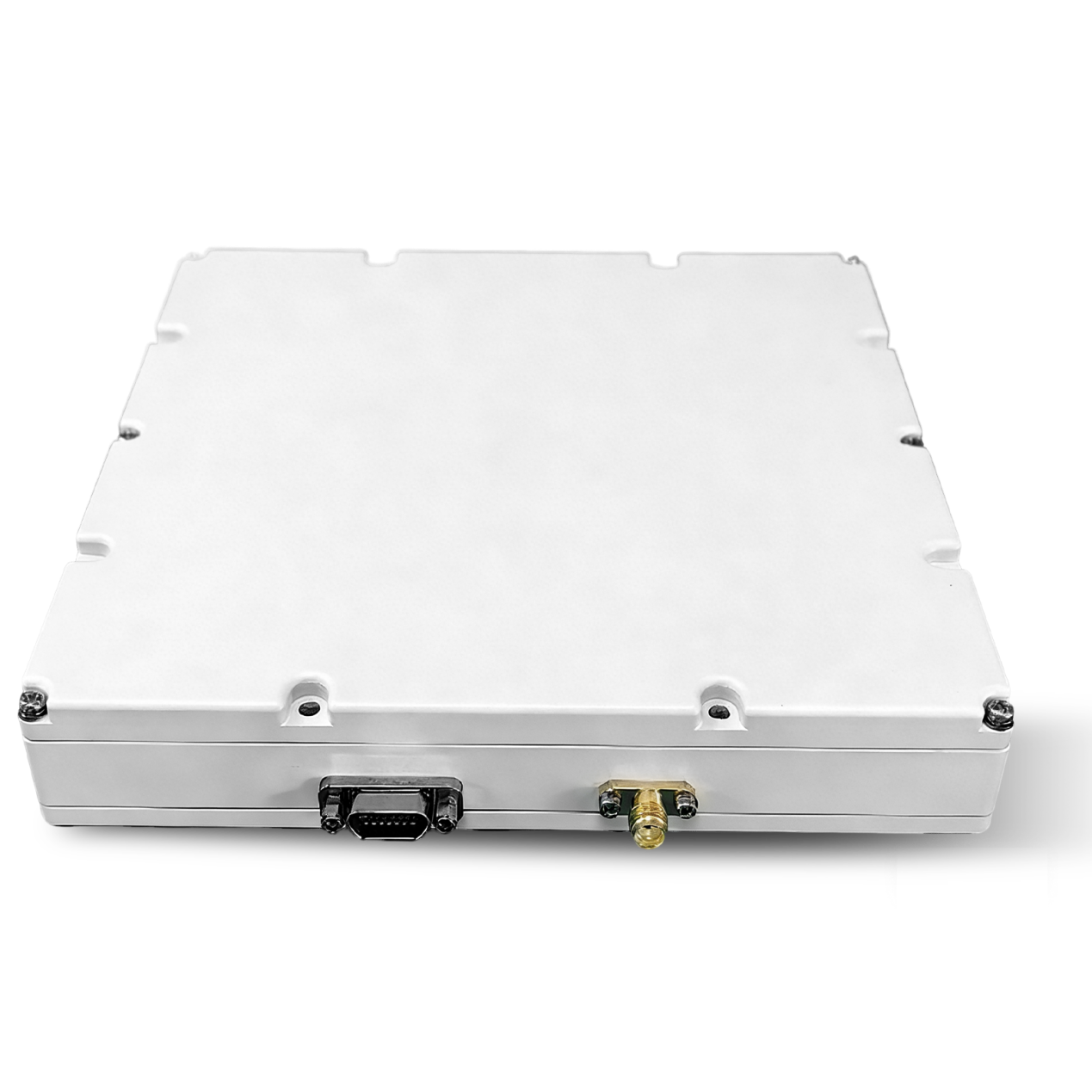 SLA-16B1L1-160
 SLA-8B1L1-165
 101 Vessel-mounted Positioning
 102 Acoustic Communication
 103 Tracking and Locating
 104 Diver Navigation System
 105 Intrusion Detection Sonar
 106 Delivery Locator Beacon
 SLLR3000
 SLLR905
 SLLD25
 108IMU
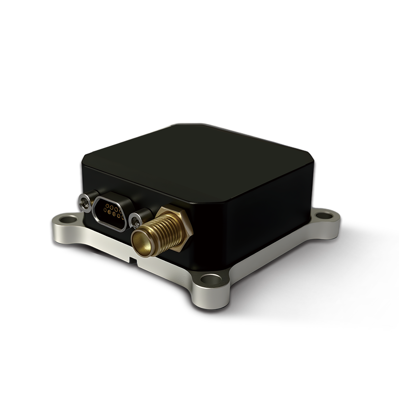 150M
150M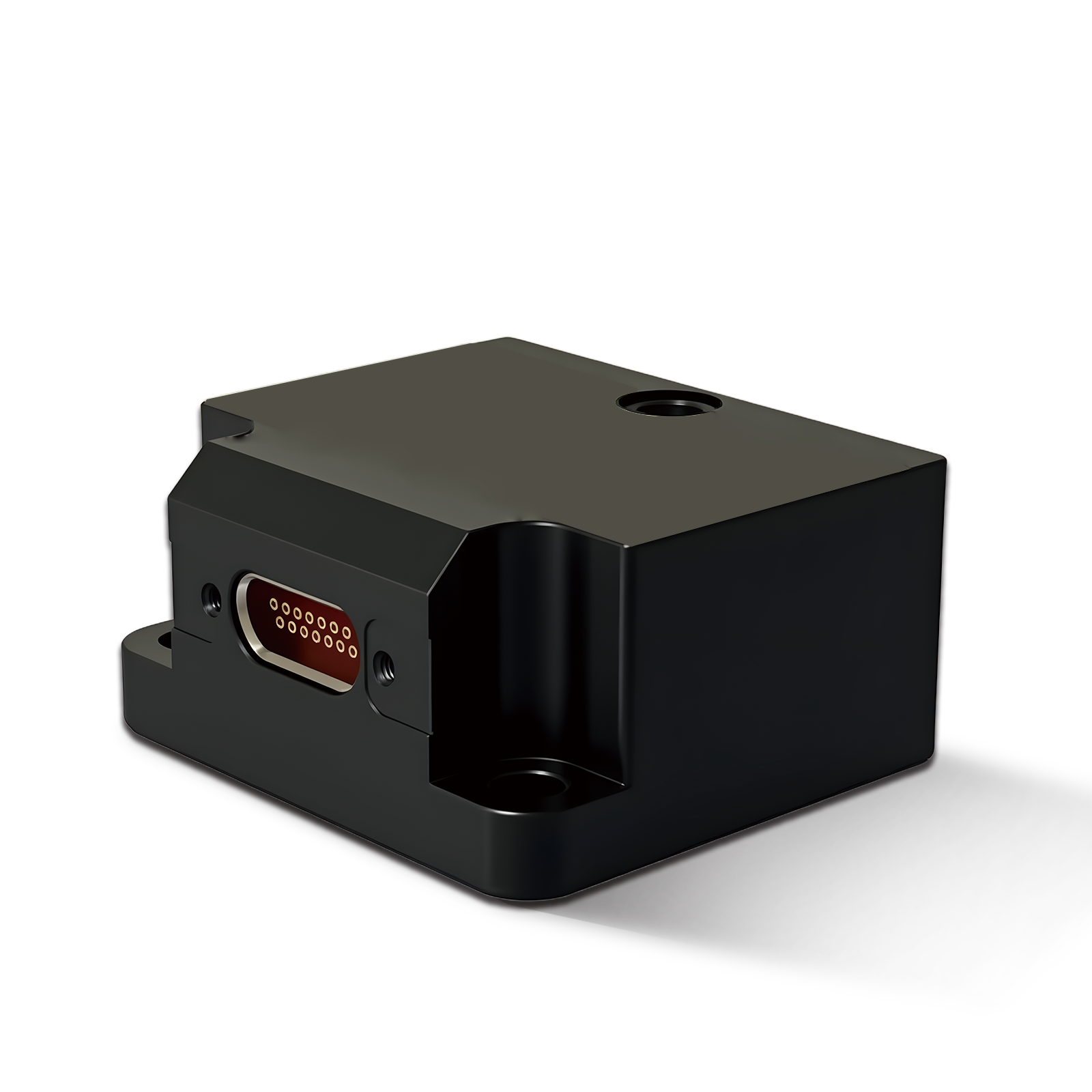 500MH
500MH 160M
160M 170M
170M SLFC-70
 SLAF280
 MR360
MR360
Leave Your Message
Explore our flagship precision navigation products engineered for demanding environments — from Manila Bay vessel operations to Philippine infrastructure mapping projects.
Micro-nano Angular Rate Sensor Fiber Optic Gyro with Start Time Less Than 1s
Fast-Start FOG
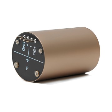
Fiber Optic Gyro BSD50 Compact & Precision Engineered Angular Speed Sensor
Compact FOG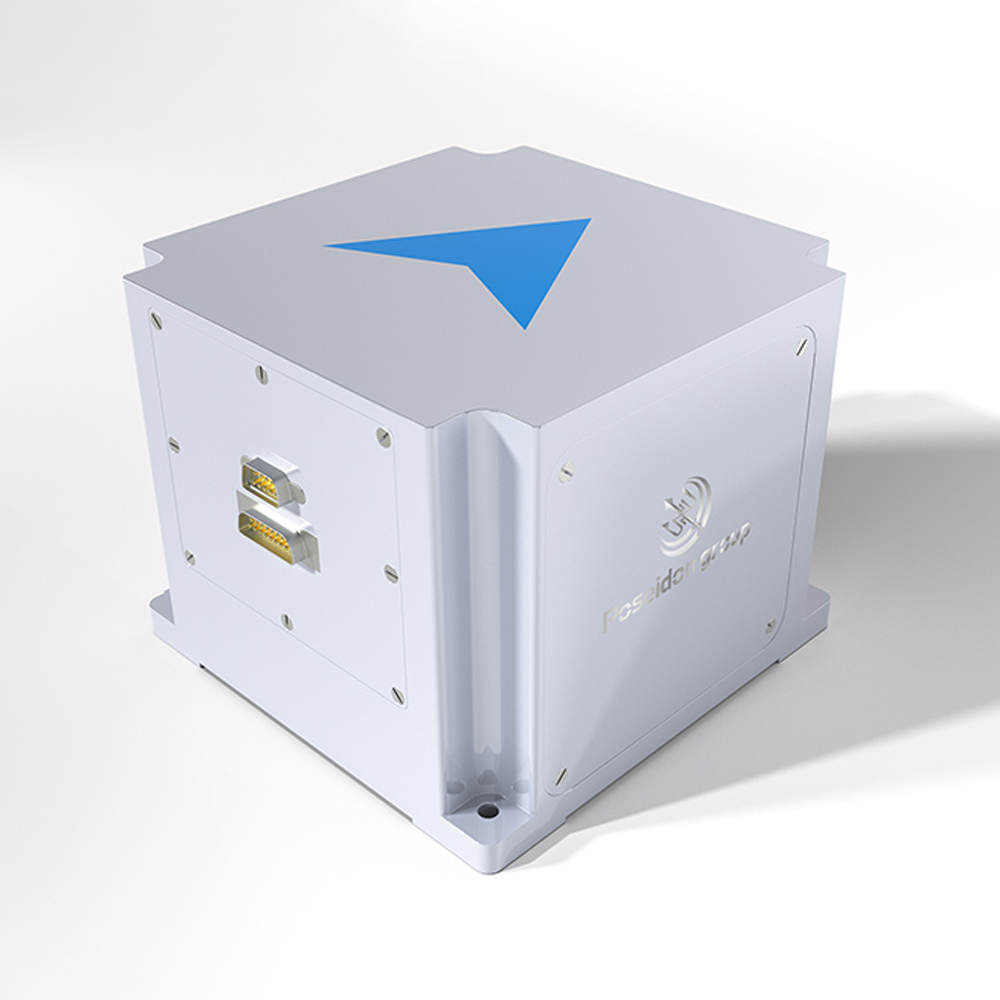
GPS-Prohibited Zone Integrated Navigation INS1700 with Anti-Interference
INS System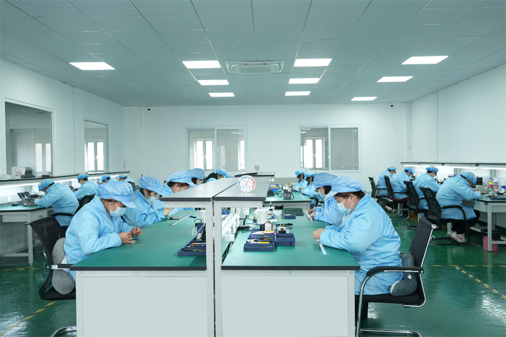
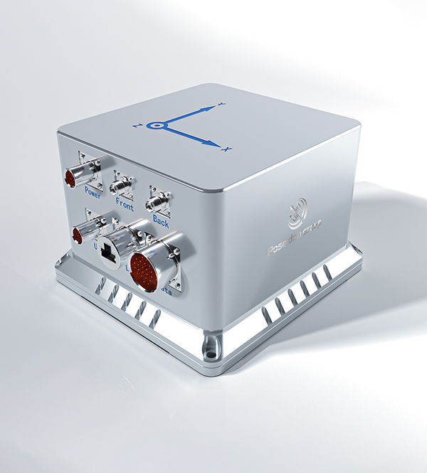
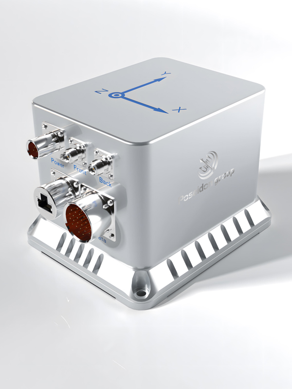
High-Stability Gyro Compass Mapping Unit for Marine & Survey Applications
Mapping UnitThe Manila market has emerged as one of Southeast Asia's most dynamic hubs for precision navigation technology. As the Philippines accelerates its infrastructure development under the "Build, Better, More" program, demand for high-accuracy Gyro Compass Mapping Units has surged across maritime, construction, mining, and surveying sectors.
Manila Bay — one of the busiest waterways in Asia — hosts thousands of commercial vessels daily, each requiring reliable gyrocompass systems for safe navigation. Port operators at the Port of Manila, Batangas Port, and Subic Bay Freeport Zone increasingly specify advanced gyro compass mapping units that combine heading accuracy with integrated GNSS capabilities.
Beyond maritime, the booming real estate and infrastructure sectors in Metro Manila, Cebu, and Davao are driving demand for terrestrial mapping units. Gyro compass technology is now integral to tunnel boring machines (TBMs) used in the Metro Manila Subway project, as well as LiDAR-equipped survey drones mapping topography across Luzon and Visayas.
Our Gyro Compass Mapping Units are deployed across a wide spectrum of industries in Manila and greater Philippines, delivering unmatched heading accuracy in complex operational environments.
Commercial ferries, cargo vessels, and coast guard ships operating in Manila Bay rely on our gyrocompass units for precise heading data. The congested waterway demands sub-0.1° accuracy, especially during typhoon season when GPS signals are frequently disrupted by atmospheric interference.
The 33-km Metro Manila Subway — the Philippines' first underground mass transit system — requires gyro-guided TBMs for millimeter-precision boring. Our inertial navigation systems provide continuous heading and position data where GPS is completely unavailable underground.
NAMRIA (National Mapping and Resource Information Authority) and private survey firms in Luzon, Visayas, and Mindanao use gyro-stabilized mapping platforms for cadastral surveys, flood risk mapping, and coastal monitoring — critical work in a country highly vulnerable to natural disasters.
The Philippines is among the world's top nickel and copper producers. Mining operations in Surigao, Palawan, and Zambales deploy gyrocompass mapping units in underground ore tracking systems and surface haul road automation, improving extraction efficiency and worker safety.
The West Philippine Sea holds significant hydrocarbon reserves. Offshore survey vessels conducting seismic exploration require ultra-stable gyrocompass mapping units to maintain precise positioning during multi-day survey runs, ensuring accurate sub-seafloor mapping data.
Agricultural mapping across Pampanga's rice fields, disaster assessment in typhoon-hit areas, and urban planning surveys in Quezon City all leverage gyro-stabilized drone platforms. Our compact FOG units are the preferred choice for payload-sensitive UAV applications.
The gyrocompass and inertial navigation market in the Philippines is undergoing rapid transformation, driven by technology convergence, regulatory changes, and infrastructure investment.
The integration of GNSS with inertial navigation systems (INS) is becoming the industry standard in Manila. Hybrid systems provide continuous positioning even in GPS-denied environments like urban canyons in BGC and Makati, underground tunnels, and forested mountain terrain in the Cordillera region.
The Philippine Coast Guard and MARINA (Maritime Industry Authority) are developing frameworks for autonomous and remotely operated vessels. Gyro compass mapping units form the core navigation backbone of these unmanned maritime systems, opening a significant new market segment.
Demand for micro-nano scale gyroscopic sensors is accelerating as Manila-based tech startups and system integrators develop compact navigation solutions for drones, wearables, and IoT devices. Our BSD217 micro-nano FOG with sub-1-second startup time addresses this growing segment.
Manila's smart city initiatives — including the digitization of Metro Manila's road network and Pasig River rehabilitation monitoring — require continuous, high-precision geospatial data feeds that only gyro-stabilized mapping platforms can deliver with the required accuracy.
Traditional mechanical gyroscopes are rapidly being replaced by Fiber Optic Gyroscopes in Philippine naval and survey applications. FOG technology offers superior MTBF (Mean Time Between Failures), no moving parts, and significantly better performance in tropical humidity and temperature conditions.
The Philippine government's PhilSys digital ID program, DPWH infrastructure projects, and AFP (Armed Forces of the Philippines) modernization program collectively represent a multi-billion peso market for precision navigation equipment, with local supplier preference policies creating opportunities.
Engineered for the demanding tropical conditions of the Philippines — from typhoon-force winds to high-humidity coastal environments — our navigation systems deliver where others fail.
Industry-leading angular accuracy ensures your vessel, drone, or survey platform maintains precise orientation even in challenging sea states or turbulent flight conditions common in Philippine typhoon corridors.
Our micro-nano FOG technology achieves operational readiness in under 1 second — critical for emergency response vessels in Manila Bay and rapid-deployment survey teams responding to natural disaster events.
Full navigation capability in GNSS-denied environments including underground tunnels, dense urban canyons in Makati CBD, electronic warfare zones, and deep jungle terrain across the Philippine archipelago.
Designed to operate reliably in temperatures from -40°C to +85°C with humidity resistance up to 95% RH — perfectly matched to the Philippines' challenging tropical maritime climate year-round.
From single-axis rate sensors to full 9-DOF integrated navigation systems, our modular architecture allows Manila-based system integrators to build custom solutions for specific industry requirements without redesigning from scratch.
Dedicated technical support covering all Philippine time zones, with remote diagnostics, firmware updates, and on-site service coordination through our Manila-area partner network ensuring minimal downtime.
Every Gyro Compass Mapping Unit we supply to the Manila market is backed by world-class R&D, manufacturing, and quality assurance infrastructure.

Core Component Self-Development
↓ Reducing costs by 25%
Proprietary System Algorithms
↑ Improving performance by 20%
Scalable Mass Production
✔ Stable quality & efficiency
Comprehensive Integration
🔗 Components to full systems
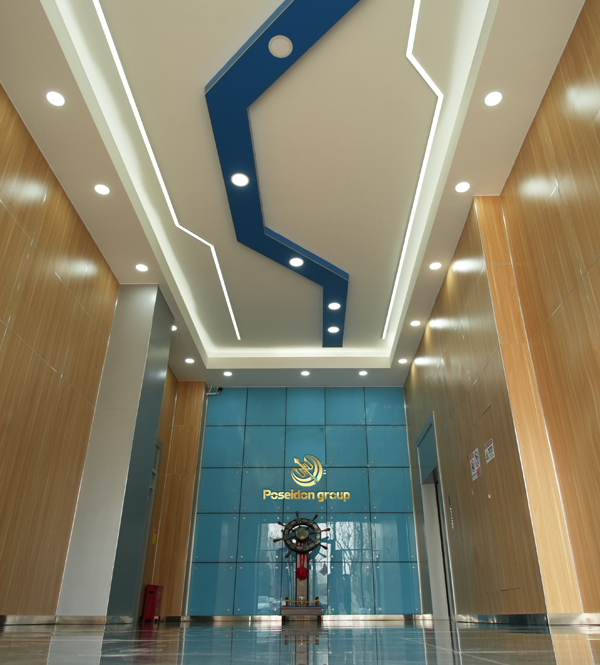
Poseidon International Group (Hong Kong) Limited — Connecting the World Through High Accuracy Navigation Technology
Based in Hong Kong, we are a global enterprise dedicated to delivering high-quality products and professional services. We have established long-term, stable, and efficient partnerships with numerous suppliers worldwide, ensuring competitive pricing and superior product quality.
As your trusted Gyro Compass Mapping Unit supplier for the Manila market, we bridge the gap between cutting-edge Chinese navigation technology and the specific operational requirements of Philippine industries — providing not just products, but complete navigation solutions.

We provide comprehensive, all-in-one solutions, whether for components, products, systems, or complete project solutions, always ensuring the best value for our clients.

Our experienced team, with deep expertise in international trade, is dedicated to crafting cost-effective solutions tailored to customer needs.

Through close partnerships with leading logistics providers, we guarantee timely and secure deliveries to Manila and all major Philippine ports.
Our technical foundation ensures every Gyro Compass Mapping Unit delivered to Manila clients meets the highest standards of precision and reliability.

We specialize in the independent research, design, and production of fiber optic gyroscopes (FOG), inertial navigation systems (INS), attitude and control systems, autonomous driving systems, and intelligent control systems for unmanned equipment. By integrating industry-specific requirements, we have made significant technological advancements in digitalization, automation, and intelligence, securing multiple technical patents. With years of experience, we have evolved into a multi-industry intelligent solutions provider with a portfolio of proprietary core technologies.
Our core team comprises seasoned experts with extensive backgrounds in aerospace and inertial navigation. We have successfully tackled critical technological challenges in high-precision GNSS-free navigation, laser measurement, integrated navigation, multi-source data fusion, and precise positioning — areas that were once bottlenecks in the industry.


Our products are smaller in size, higher in accuracy, and more stable in performance, featuring long-term dynamic auto-calibration with zero-drift operation. They are widely adopted in scientific research, industrial control, intelligent unmanned systems, high-precision detection, and metrology. Having passed rigorous validation in aviation, aerospace, marine, mining, and railway applications, our solutions have been procured in bulk, filling key technological gaps in China.

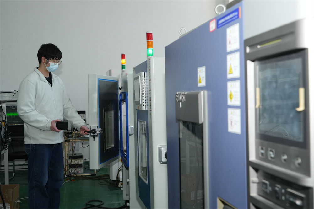
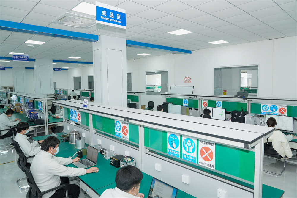
We operate over 6,000-square-meter manufacturing facility in mainland China, equipped with advanced R&D, production, and testing infrastructure, enabling large-scale production and timely delivery. Our network of subsidiaries, offices, and spare parts warehouses across China ensures prompt technical support and after-sales service for all Manila and Philippine clients.
Poseidon International Limited, Hong Kong strives to provide satisfactory products and services to customers from all walks of life. Compared to similar companies, we offer unique advantages:

Creating mutually beneficial relationships with clients and partners across the Manila market and broader Philippines.

Commitment to ethical business practices and transparent communication throughout every project lifecycle.

Providing clear, one-time offers with no hidden costs — making budgeting straightforward for Philippine procurement teams.

24/7 service guarantee in all time zones with minimal response time — critical for time-sensitive maritime and survey operations.
Browse our full lineup of precision navigation instruments available for supply to the Manila market — from micro-nano FOG sensors to complete integrated navigation systems.
Micro-nano Angular Rate Sensor Fiber Optic Gyro with Start Time Less Than 1s
BSD217 SeriesFiber Optic Gyro BSD50 Compact & Precision Engineered Angular Speed Sensor
BSD50 SeriesINS1700 GPS-Denied Zone Integrated Navigation with Anti-Interference System
INS1700High-Stability Gyro Compass Mapping Unit for Marine Survey Applications
Marine SeriesMulti-Axis Inertial Navigation System for Autonomous Unmanned Platforms
INS PlatformAttitude & Heading Reference System (AHRS) for Aviation and UAV Applications
AHRS SeriesHigh-Precision FOG Gyroscope for Industrial Control & Robotics Integration
Industrial FOGIntegrated GNSS-INS Navigation System for Precision Land Survey & Mapping
GNSS-INSGuided by the vision of "Connecting the World through Inertial Navigation", we strive to push the boundaries of navigation technology, aiming to become a leading integrated solutions provider with a broad product portfolio and advanced competencies. Whether you are a maritime operator in Manila Bay, a survey engineer in Luzon, or a mining company in Mindanao — we have the right gyrocompass solution for your needs.
Contact Us Today!